{:th}
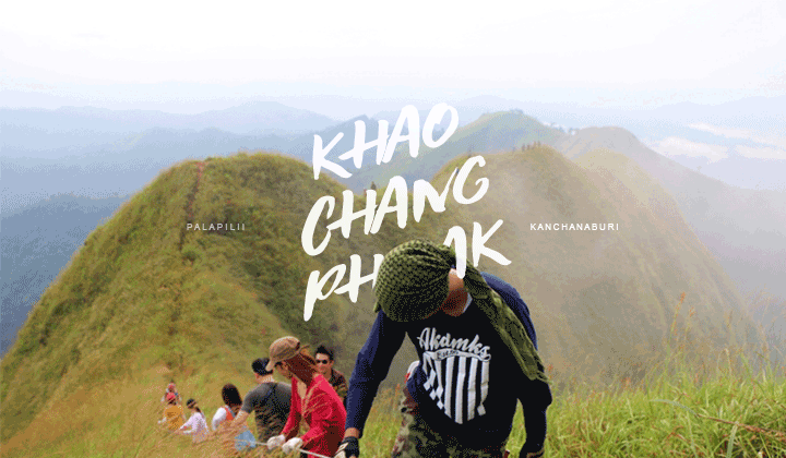
Backpack เขาช้างเผือก ด้วยเงิน 1,000 บาท
:: ถ้าจะให้ผมจัดอับดับทางเดินสู่ยอดเขาในประเทศไทยที่สวยงามและเหมาะสำหรับผู้เริ่มต้นมากที่สุด
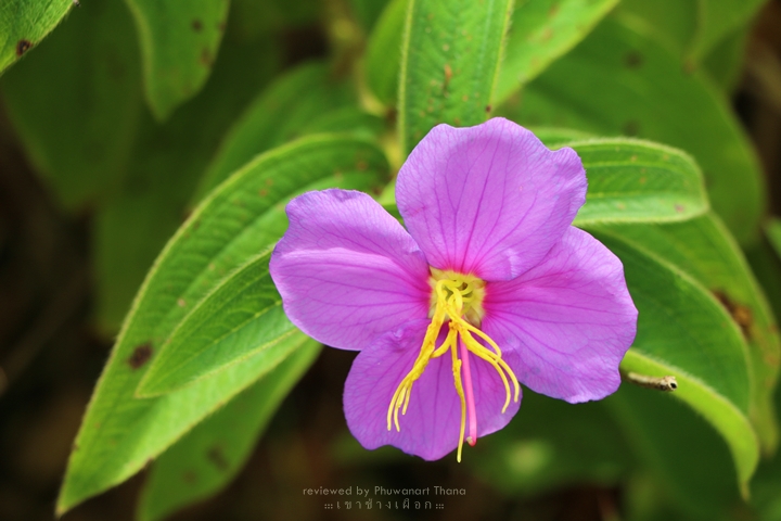
ผมคงจะปฏิเสธไม่ได้ว่าเป็นที่นี่ “เขาช้างเผือก” อ.ทองผาภูมิ จ.กาญจนบุรีครับ
reviewed by : https://www.facebook.com/PalapiliiThailand
————————————————————————————————————————-
ถนนเส้นนี้
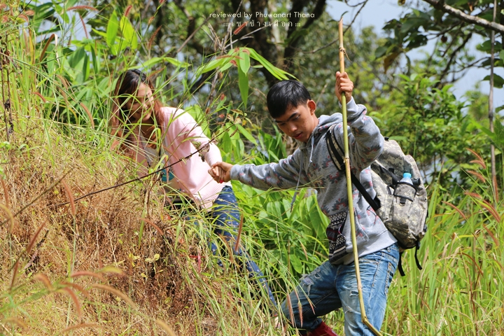
:: จริงๆ แล้วการเดินทางไปเขาช้างเผือก มีหลายวิธีมากๆ เลยนะครับ แต่ถ้าจะให้ผมแนะนำ
คือการขับรถมาเองแล้วพาเพื่อนๆ ขึ้นรถมาด้วยซักสามสี่คนจะดีไม่ใช่น้อย
เพราะพวกเค้าคือคนที่จะมาช่วยเฉลี่ยค่าใช้จ่ายตั้งแต่ต้นจนจบทริปให้เรานั่นเอง ๕๕๕
แต่ถ้าจะให้ work สุดๆ โบกรถเลย ถูกแน่นอน ถูกถีบอะ!
หลอกๆ โบกเลยครับ คนไทยน้ำใจงามจัดตายยยย 55555
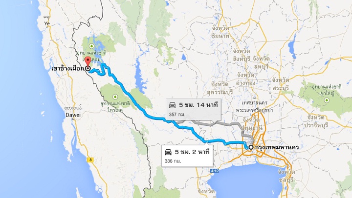
:: ระยะทางจากกรุงเทพฯ ถึงหมู่บ้านปิล๊อค (จุด Start การเดินเท้า) มีระยะทางเกือบ 400 กิโลเมตร เ
พื่อนๆ สามารถ search หาข้อมูลการเดินทางได้ทั่วไป ผลัดกันขับกับเพื่อนๆ ก็ได้
ใช้เวลาราวๆ 5 – 6 ชั่วโมงก็ถึงอย่างสบายๆ แต่ถ้าใครขาโหด 4 ชั่วโมงก็ได้ ไม่ว่ากัน
อย่างไรก็ตาม ขอให้อยู่ในความไม่ประมาทด้วย
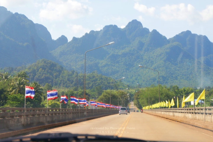
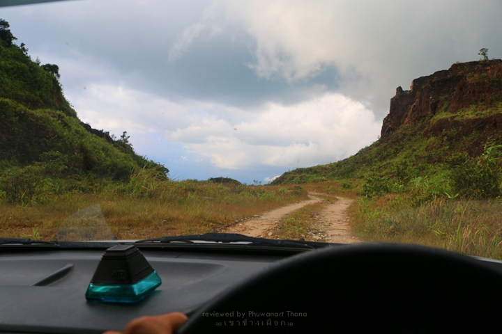
:: หนทางจากกรุงเทพฯ จนถึง อ.ทองผาภูมิสบายมากครับ ลาดยางมาชิลๆ ใครเติมแก็ส ก็ให้เติมตุนไว้ที่นี่เลย
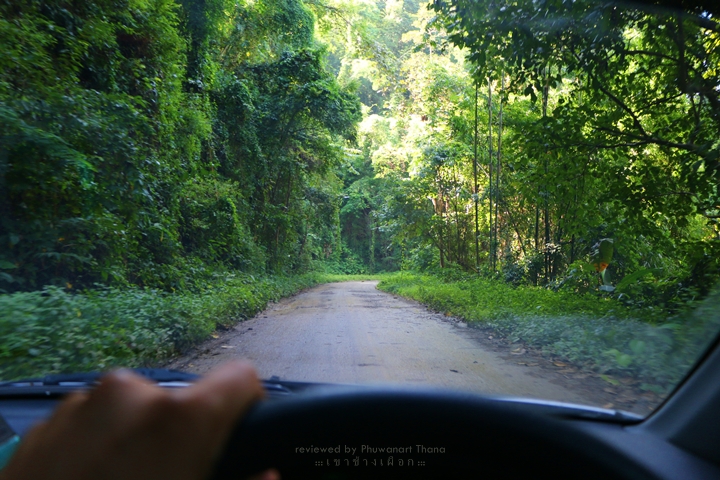
เพราะข้างบนไม่มีปั้มแก๊สแล้ว หลังจากนี้ถนนจะเต็มไปด้วยความทรหดคดโค้ง
ผมไปมาล่าสุดทางนิเหี้_มากๆ ถนนขรุขระโคตรๆ บางช่วงถนนแตกข้างทาง หล่นลงไปคือเหวกับเหว
ถนนจะลื่นซะส่วนใหญ่เพราะป่ายังดูดมสมบูรณ์จนต้นไม้ใบหญ้าข้างทางล้ำถนนเข้ามาเกินงามเลยหล่ะ
เอาเป็นว่า ระยะทางจาก อ.ทองผาภูมิไปหมู่บ้านปิล๊อคแค่ 60 กิโลเมตร
แต่จะต้องใช้เวลากว่าหนึ่งชั่วโมงหรือถ้าใครรักรถคงจะสองชั่วโมงอย่างแน่นอน
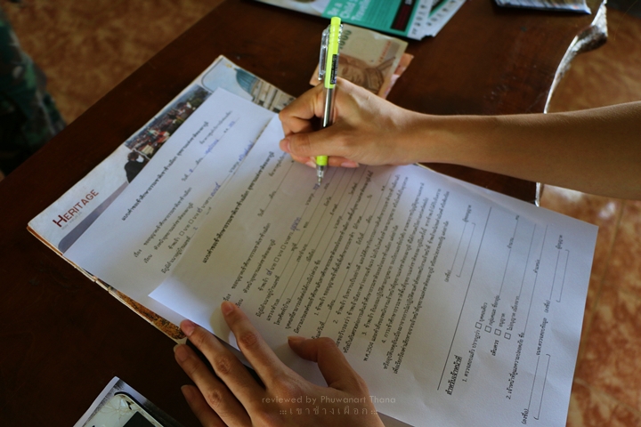
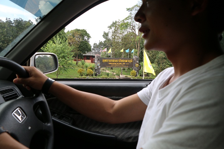
:: ก่อนเข้าหมู่บ้านจะต้องจอดที่ อช.ทองผาภูมิก่อน เพื่อไปรับรู้เงื่อนไขและจ่ายค่าผ่านทางต่างๆ
(เราจะต้องจองมาก่อนล่วงหน้า 7 วันตามที่อุทยานกำหนด) ไม่ว่าจะเป็นค่าขึ้นเขา ค่าเข้าอุทยาน
ค่ากางเต็นท์ข้างบน รวมไปถึงค่านำทางอีกด้วย โดยค่าใช้จ่ายหลักๆ ก็จะมีราคาประมาณนี้
2. ค่าเอารถเข้าอุทยาน 40 บาท
3. ค่ากางเต็นท์ 30 บาท
4. ค่านำทาง 1,200 บาท (นำได้ 10 คน)
5. ค่าลูกหาบคนละ 1,100 บาท (2 วัน 1 คืน)
สำหรับผมผมตัดค่าลูกหาบทิ้งไปเลย เพราะการขึ้นเขาช้างเผือก
มันไม่ได้ยากเยนอะไรขนาดที่จะต้องให้ใครมาแบกของให้เรา แบกขึ้นไปเองภูมิใจกว่าเยอะ
:: เมื่อเห็นค่าใช้จ่ายเบื้องต้นแล้ว เพื่อนๆ คิดว่าควรมาคนเดียวหรือลากเพื่อนขึ้นรถมาด้วยหละครับ
ผมจะลองคำนวณค่าใช้จ่ายคร่าวๆ ก่อนที่จะขึ้นไปพิชิตเขาช้างเผือกให้เพื่อนๆ
ได้เห็นงบประมาณโดยคิดเงื่อนไขที่ 10 คน ตามที่อุทยานได้กำหนดมาให้
ราคาจะอยู่ที่ 1,750 บาท ตีให้เลย 2,000 บาท ขับไปเองไปกันคันละ 5 คน ก็ตกคนละ 400 บาท (ต้องมีรถยนต์ส่วนตัว)
2. ค่าขึ้นเขา 30 บาท/คน
3. ค่ากางเต็นท์นอนบนเขา 30 บาท/คน
4. ค่านำรถเข้าอุทยานฯ 40 บาท/คัน หารกัน 5 คน ตกคนละ 8 บาท (แต่ไม่ต้องหารก็ได้มั้ง)
5. ค่านำทางของเจ้าหน้าที่ 1,200 บาท/10 คน เมื่อหารกันจะตกคนละ 120 บาท
6. ค่าเสบียงอาหารเฉลี่ยวันละ 100 บาท (คิดที่ 2 วัน) จะตกที่ 200 บาท
7. ค่าอื่นๆ คนละ 200 บาท
เมื่อเอาแต่ละรายการมารวมกัน เราก็จะเห็นตัวเลขสำหรับทริปสั้นๆ ทริปนี้
เอาหละ มาบวกให้เห็นกันไปเลยดีกว่าว่างบสำหรับการขึ้นเขาช้างเผือกจะมีราคาเท่าไหร่กัน
:: 400 + 30 + 30 + 8 + 120 + 200 + 200 ::
—– รวมเป็นเงิน 888 บาทถ้วน (แปดร้อยแปดสิบแปดบ้านถ้วน) —–
หึหึ เป็นไงหล่ะ อึ้งกันไปเลยหละสิ!!
(ต่อให้เปลี่ยนเป็นรถน้ำมันไม่ใช้แก็ส ราคาก็จะอยู่ที่บวกลบ 1,000 บาท ไม่หนีไปไหนแน่นอน)
————————————————————————————————————————-
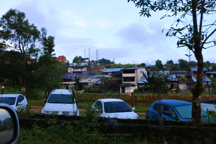
บ้านปิล๊อค
:: จากตัวอุทยานมาถึงหมู่บ้านปิล๊อคก็ใช้เวลาไม่นานครับ เพราะระยะห่างกันเพียง 10 กิโลเมตรเท่านั้น
ก่อนถึงหมู่บ้านราวๆ 2 – 3 กิโล จะมีจุดชมวิวสวยๆ อยู่ที่หนึ่งชื่อเนินช้างศึก ยั
งไงถ้ามีเวลาแวะก็อยากให้แวะกันครับ เลี้ยวซ้ายเข้าไปเลย ถนนไม่โอเคเท่าไหร่ครับ
เพราะสมัยก่อนบริเวณนี้เป็นเหมืองหินมาก่อน ทางเลยมีแต่หินกับหิน หินที่ว่านิคือหินจริงๆ นะครับ
ยังไงไปเดี่ยวก็เห็น จากปากซอยจนไปถึงเนินช้างศึกราวๆ 3 กิโลเมตรครับ
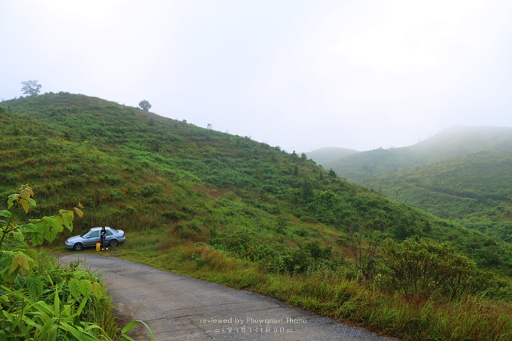
:: รถผมคงเก่ามันขึ้นไปไม่ถึงครับ จะมีจุดๆ หนึ่งที่เป็นทางขึ้นดิ่งตรงยาวเลย
รถผมเก่าแล้วขึ้นไปไม่ไหวจริงๆ ต้องจอดไว้ข้างทางแล้วโบกรถคันอื่นขึ้นไปชมวิวข้างบน
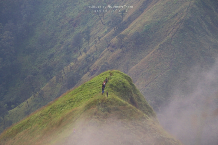
:: วิวข้างบนจะเห็นตัวหมู่บ้านทั้งหมู่บ้านครับ จะเห็นทิวเขาที่สลับซับซ้อนสวยงามมาก
สมัยก่อนตรงนี้เป็นป้อมปราการของทหารในช่วงที่ยังมีสงครามกันอยู่ ถือว่าเป็นจุดยุทธศาสตร์ที่ดีมากๆ
ช่วงที่ผมไปหมอกหนาไปหน่อย เลยเห็นวิวไม่ร้อยเปอร์เซ็นต์เท่าไหร่
แต่ก็คุ้มค่าครับ ถือเป็นวิวแรกที่สวยงามของการเดินทางครั้งนี้
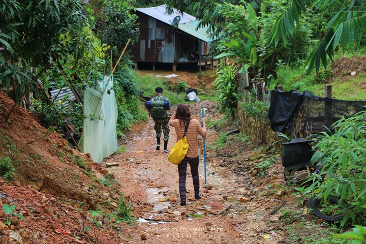
:: เดินทางมาถึงหมู่บ้านปิล๊อคก็หาที่จอดรถซะนะครับ เพราะทางเข้าหมู่บ้านไม่เหมาะที่จะเอารถไปจอดเท่าไหร่
ผมแนะนำให้ขับเลยไปนิดหนึ่งแล้วไปจอดไว้หน้าโรงเรียน หรือถ้าไม่ซีเรียสก็จอดข้างทางไปเลยครับ
แล้วรีบเก็บข้าวของสัมภาระเตรียมพร้อมที่จะขึ้นหลังช้างกันได้แล้ว
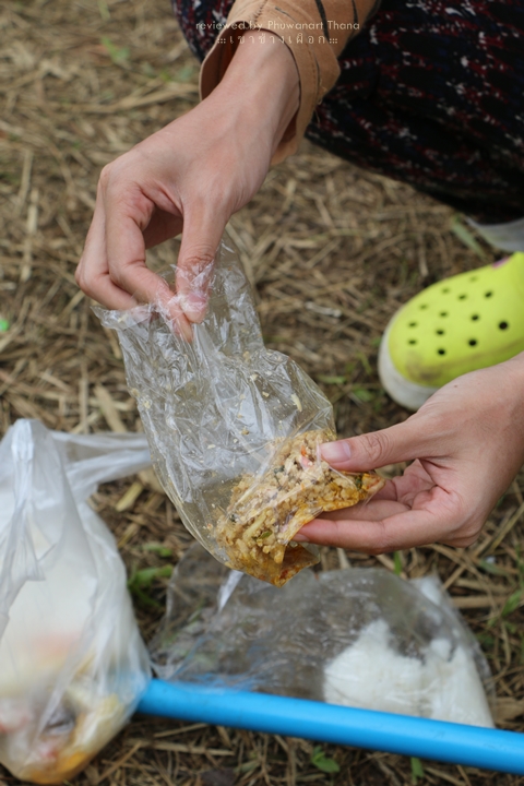
:: ในหมู่บ้านปิล๊อคมีร้านเก่าแก่อยู่ไม่กี่ร้านหรอกครับที่นักท่องเที่ยวจะไปใช้บริการอาหารเช้าหรือกาแฟร้อนกันก่อนขึ้นเขา
ถ้าเป็นร้านอาหารก็ต้องเป็นร้านพี่หน่อย ถ้าเป็นร้านนั่งชิลก็ต้องเป้นร้านพี่แอ๊นท์ (Coffe in pilok)
ยังไงก็ลองไปชิมกันดู รับรองจะไม่เสียใจ
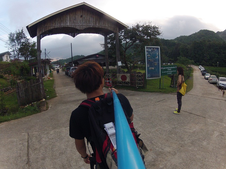
:: เมื่อเราใช้เวลาส่วนตัวเสร็จเรียบร้อย ก็ถึงคราวที่เราจะต้องเตรียมพร้อมลุยเขากันจริงๆ แล้วหล่ะครับ
ที่หมู่บ้านจะมีร้านค้าร้านใหญ่อยู่ร้านเดียว ร้านนั้นคือจุดรวมพลของนักท่องเที่ยวและเจ้าหน้าที่อุทยาน
รวมไปถึงเป็นสถานที่หาซื้อข้าวของ เสบียงอาหารก่อนขึ้นเขาอีกด้วย เมื่อทุกคนพร้อมก็ให้ไปหาเจ้าหน้าที่บริเวณนั้นเลย
พร้อมเอาบัตรที่ได้จากตัวอุทยานฯ มาโชว์ให้เจ้าหน้าที่ดู ว่าถูกต้องตามเรื่องราวที่เราคุยกันไว้รึป่าว
และเมื่อทุกอย่างพร้อม การเดินทางครั้งนี้ก็จะเริ่มขึ้น…
————————————————————————————————————————-
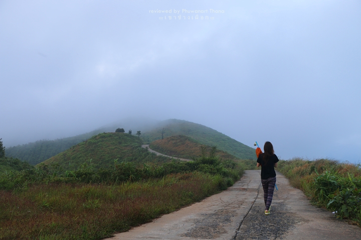
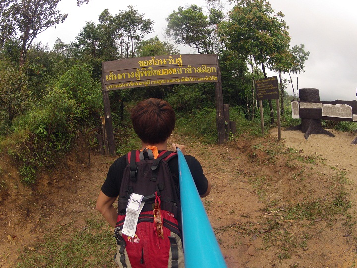
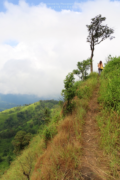
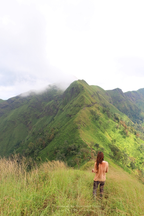
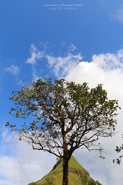
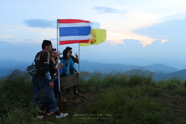
เขาช้างเผือก
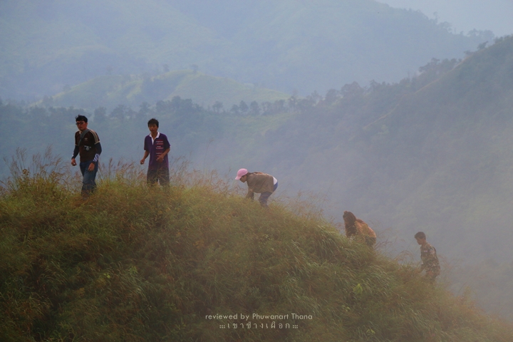
:: หลังจากนี้จะเป็นบรรยากาศเส้นทางการเดินขึ้นเขาช้างเผือกที่ผ่านสายตาและเลนส์จากกล้องของผมนะครับ
ปล่อยให้ภาพบรรยายตัวของมันเองแล้วกัน…
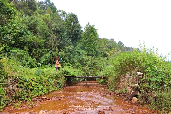
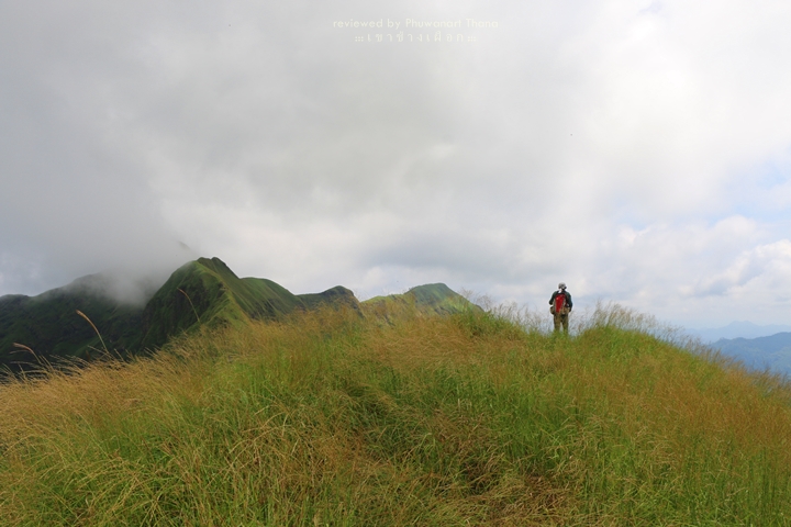
:: เวลามาตรฐานของการขึ้นเขาช้างเผือกอยู่ที่ 4 ชั่วโมงสำหรับนักท่องเที่ยวทั่วไป
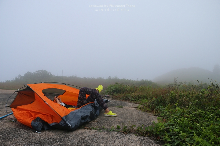
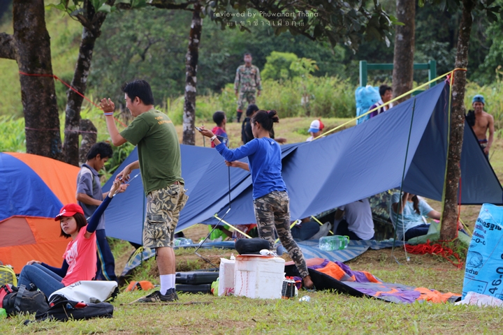
ซึ่งมีระยะทางในช่วงแรกประมาณ 7 กิโลเมตร จุดแรกที่เราจะไปคือ Base Camp ครับ
พอเราขึ้นไปถึง Base Camp ก็รีบหาที่กางเต็นท์ หา Location เหมาะๆ เลยนะครับ
สำหรับผมผมแนะนำให้จองในที่ต่ำๆ เพราะตอนกลางคืนลมจะแรงมาก บางเดือนแรงจนกระทั่งไม่ต้องนอนกันเลยหละ
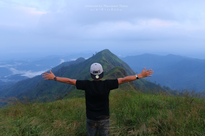
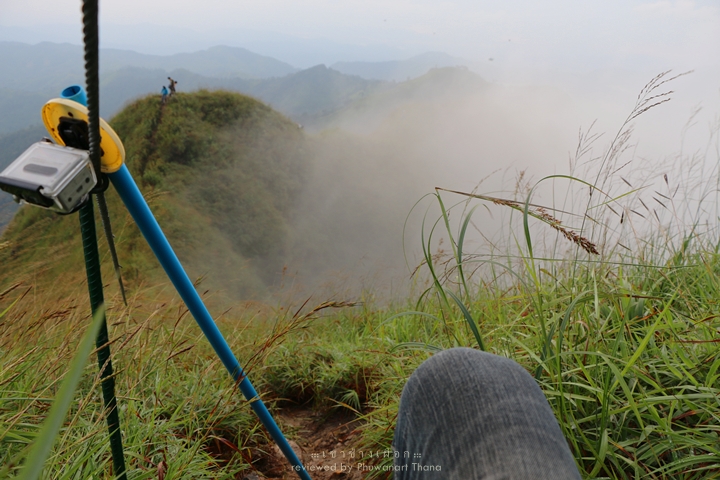
และก็ไม่ต้องกลัวว่าไปเขาช้างเผือกจะไม่เห็นหมอก 1,000 เปอร์เซ็นสำหรับการเห็นหมอกบนเขาช้างเผือกครับ
:: ระหว่างนี้เค้าจะไม่ให้เราขึ้นไปต่อครับ เราต้องนอนรอเจ้าหน้าที่จนกว่าจะได้เวลาที่สมควร
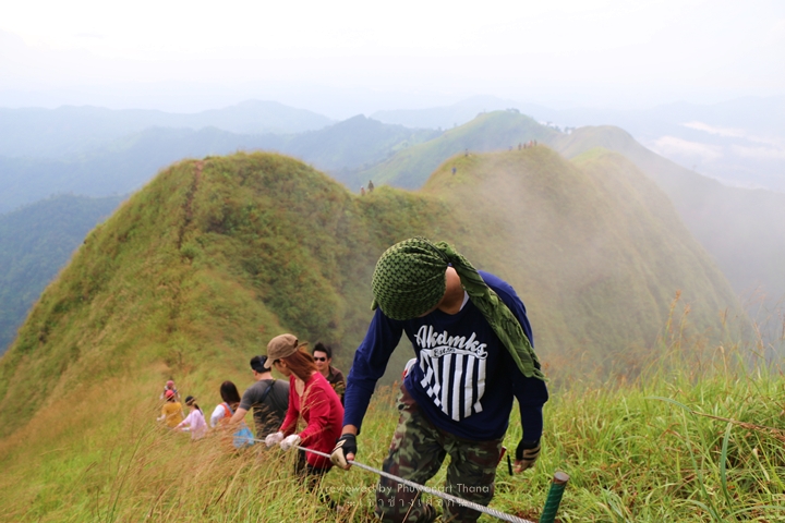
ซึ่งเวลานั่นคือ 4 โมงเย็น เป็นเวลาที่เจ้าหน้าที่จะพาเราขึ้นไปจุดหลักสำคัญอย่าง สันคมมีด หลังช้าง และยอดสุดของเขาช้างเผือก
ซึ่งจุดนี้จะเป็นช่วงที่สองของการเดินทาง ซึ่งเป็นระยะทาง 1.5 กิโลเมตรสั้นๆ ที่คุณจะไม่มีวันลืม…
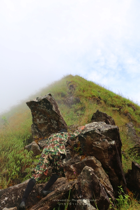
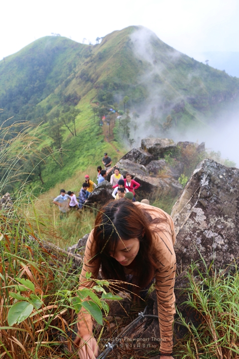
” สั น ค ม มี ด “
https://www.facebook.com/video.php?v=774141719346276&set=vb.339207546173031&type=2&theater
” ห ลั ง ช้ า ง “
https://www.facebook.com/video.php?v=774777052616076&set=vb.339207546173031&type=2&theater
:: อยากให้เตรียมไฟฉายไปด้วยคนละกระบอก เผื่อเกิดเหตุฉุกเฉินที่กลับจากช่วงที่สองช้ากว่าปกติ
ฟ้าอาจจะมืดจนทำให้มองไม่เห็นทางลง อย่างไรก็ตามอยากให้ทำเวลากันให้ดีที่สุดเพื่อความปลอดภัยของตัวเอง
พอเราลงมาจากช่วงที่สอง (ช่วงสันคมมีด หลังช้าง ยอดเขาช้างเผือก) บางกลุ่มก็มาทานอาหารที่ตัวเองทำเตรียมไว้
หรือไม่ก็ช่วยกันทำอาหารกันสดๆ ตรงนั้นเลย ตรงนี้ขอไม่แนะนำอะไรนะครับ ขึ้นอยู่กับความสามารถและแรงที่เหลือของแต่ละกลุ่ม
แต่เอาเป็นว่า ใช้เวลาข้างบนนั้นให้คุ้มค่าที่สุด ให้เหมือนกับว่ามันเป็นวันสุดท้ายของชีวิต
:: ปกติแล้วเจ้าหน้าที่จะพาลงเขาตั้งแต่ช่วงเช้าครับ เจ็ดโมงเช้าเป็นเวลามาตรฐาน
นักท่องเที่ยวทั่วไปจะใช้เวลาลงเขาประมาณ 3 ชั่วโมง เดินกลับทางเดิมเลย
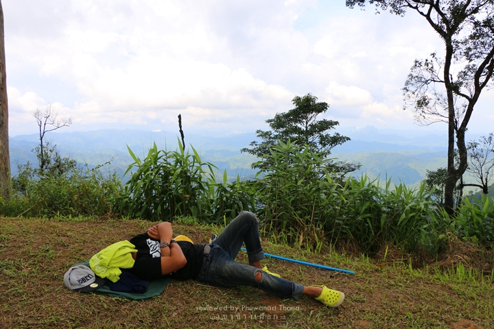
เมื่อเราเดินลงมาถึงหมู่บ้านปิล๊อค หากมีแรงเหลืออยากจะเที่ยวต่อ ย่อมมีครับ
และสถานที่เที่ยวสำคัญในเมืองแห่งนี้คงจะหนีไม่พ้น “เหมืองสมศักดิ์” และ “น้ำตกจ๊อกกระดิ่น”
มาถึงตรงนี้แล้ว อยากให้เพื่อนๆ ทุกคนเที่ยวกันอย่างมีความสุข อยู่ในความไม่ประมาท
และกลับบ้านกันอย่างปลอดภัยทุกคนนะครับ
ภูวนาท ทานะ
#Below5000THB
{:}{:en}
:: If ask me to rank the most beautiful mountain in Thailand which suits for beginners, I have to say “Khao Chang Phuak”, Amphoe Thong Pha Phoom, Kanchanaburi.
Reviewed by : https://www.facebook.com/PalapiliiThailand
Previous review
:: Backpack at Luang Phra Bang – Wang Wiang – Wiang Chan with 5000 THB
http://pantip.com/topic/31480606
:: Backpack at Nakorn Wat – Nakorn Thom with 2500 THB
http://pantip.com/topic/32255585
:: Backpack at Wang Wiang with 2500 THB
http://pantip.com/topic/32303037
:: Backpack at Tee Lor Su – Pri Tho Lor Su with 3000 THB
http://pantip.com/topic/32131519
:: Backpack at Pak Sae – Da Nung – Hoi Aun with 6000 THB
http://pantip.com/topic/32495990
:: 30 to know before backpack at Singapore
http://pantip.com/topic/32411379
:: Backpack at Phu Chi Fah – Doi Mae Salong – Choui Fong Tea Field with 3000 THB
http://pantip.com/topic/32673881
:: Backpack at Similan – Tachai – Mu Koh Surin – Khao Ta Pu – Phuket with 10000 THB
http://pantip.com/topic/32775329
:: 10 things to know before backpack at Khao Chang Phuak
http://pantip.com/topic/32877394

Table of contents:
The Road
http://pantip.com/topic/32878781/comment4
Baan Pilok
http://pantip.com/topic/32878781/comment5
Khao Chang Phuak
http://pantip.com/topic/32878781/comment7
Lung Chang
http://pantip.com/topic/32878781/comment9
The Journey
http://pantip.com/topic/32878781/comment11
10 things to know before backpack at Khao Chang Phuak
http://pantip.com/topic/32878781/comment12
The Road

:: Actually there are many methods to go to Khao Chang Phuak but what I would like to recommend is …
To use your personal vehicle and invite 3 – 4 friends joining the journey would be great.
Because they would share the expense since the beginning to the end of the trip. LOL
But to make it really work is to hitchhike. Thai people are deadly generous!
Just kidding, haha!!

:: Distance from Bangkok to Pilok village (starting point to go on foot) is almost 400 km.
You can search for direction at your convenience. Along the way, you can switch with friends to drive.
Without much effort, we take around 5 – 6 hours to arrive. If you are a fast driver, 4 hours is also possible.
However, please be careful.

:: The route from Bangkok to Amphoe Thong Pha Phoom is very convenient. If your vehicle requires LPG or NGV, you can store here.
Because there is no gas station on the hill. After this, the road will be full of tough curves.
The previous trip was f_cking bad. The road is extremely rough. Some part of the way is broken. Falling down would meet only abyss and abyss.
Most of the way is slipped because forest in that area is so plentiful that the branches spread into the road.
Let’s say the 60 km. distance from Amphoe Thong Pha Phoom to Pilok village requires more than an hour to arrive. If you are a car lover, it can take up to 2 hours.

:: Before entering in the village, you have to park at Thong Pha Phoom National Park in order to acknowledge conditions and pay the fees.
(We have to book 7 days in advance according to national park’s requirement.) The main charges are entrance fee, tent fee and leading fee. Approximate charges are as per below;
1. Entrance of national park 30 THB
2. Entry of vehicle 40 THB
3. Tent 30 THB
4. Leading fee 1200 THB (for 10 people)
5. Carrying bags 1100 THB per person (2 days 1 night)
Personally I deduct carrying fee because climbing Khao Chang Phuak is not that tough. Carrying own bags is more proud.

:: After seeing all costs, do you think you should come alone or invite friends?
Let me calculate the expense roughly before climbing Khao Chang Phuak.
In order to know estimate budget with condition of 10 people, according to national park’s requirement.
1. Gasoline (LPG) : Average for round trip is 700 km. (2.5 THB per km.). The cost is 1750 THB. Make it round at 2000 THB. There are 5 persons in a car, 400 THB per person (must have personal car).
2. Entrance fee 30 THB per person
3. Tent fee 30 THB per person
4. Entry fee for vehicle 40 THB per car : Divided by 5 persons = 8 THB per person (Actually don’t have to share.)
5. Leading fee by staff 1200 THB per 10 people = 120 THB per person
6. Average provisions per day 100 THB (for 2 days) = 200 THB
7. Miscellaneous cost 200 THB per person
Sum all numbers together, we will see expense for this short trip
Okay, let’s calculate budget for Khao Chang Phuak trip.
:: 400 + 30 + 30 + 8 + 120 + 200 + 200 ::
—– Total expense is 888 THB. (eight hundred eighty eight Baht) —–
Haha, how is it? Are you stunned?!
(In case the car consumes fuel, the cost would be plus/minus 1000 THB. Not more than this.)
Baan Pilok

:: From national park to Pilok village is not too long as it is only 10 km far.
Around 2 – 3 km. before reaching the village, there is a scenery point called “Nern Chang Suk”.
If you have time, please stop by. Make a left turn.
The road is not in a good condition because that area used to be rock mine. The way is full of rocks. I mean real rocks.
Anyway, you will know upon visiting the place. Distance from main road to Nern Chang Suk is 3 km.

:: As my car is old, it cannot go up the hill. There is a long steep part.
My car really can’t climb up. So, we have to park and hitchhike instead.

:: At highest peak, you can see the whole village and panoramic view of the mountains. Very stunning.
Previously this area is used to be fortress of soldiers while there was a war. It is counted as a great stronghold.
There is a thick fog when we visit. Therefore, the view is not perfectly clear.
But still worthwhile to go as it is the first nice view of the trip.

:: Upon reaching Pilok village, we have to find parking space because entrance of village is not suitable to park a car.
I would recommend to go slightly further and park in front of a school. If you are not serious, parking beside sideways is also okay.
Then gather bags getting ready to climb mountain ridge.

:: There are few old shops inside Pilok village where tourists can find breakfast or hot coffee before going up the mountain.
For food, I recommend Noi’s restaurant but chilling place should be Ant’s one (Coffee in Pilok).
Have a try and you won’t regret.

:: Finishing from personal business, it’s time to get ready.
There is one big shop in village which is meeting location of tourists and national park staffs.
This shop also supplies necessary stuffs and provisions. When everyone’s ready, we go to meet with staff.
Also, bring card received from national park to show to staff in order to confirm on what we have agreed.
And when everything’s ready, the journey begins…

Khao Chang Phuak
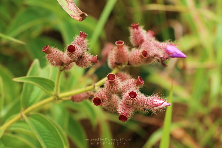
:: After this point will be atmosphere of the journey on Khao Chang Phuak representing through my camera. Let the photos describe itself…


Lung Chang

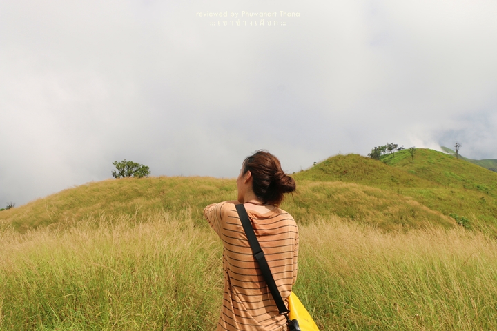
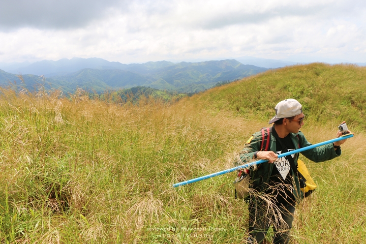
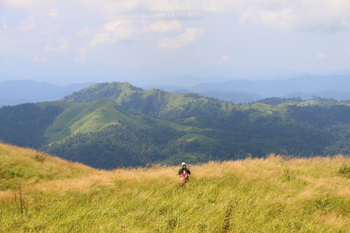
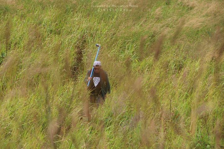
:: Average time in climbing the hill for general tourists is 4 hours.
Distance of first part is approximately 7 km. The initial place we are going is “base camp”.
Upon reaching to base camp, we find right location to set up tent.
I would suggest to find a low mound since the wind blows strongly at night. In some months, it is too windy to sleep.
And don’t be afraid of not seeing the fog. On Khao Chang Phuak, you will definitely, like 1000%, see it.

:: During this time, we are no allowed to mount further. So, we have wait to for staff until the right time.
At 4.00PM, staff brings us to significant point which is “San Kom Meed”, “Lung Chang” and “The Peak of Khao Chang Phuak”.
This is the second part of the journey which is a memorably short distance of 1.5 km…


” San Kom Meed ”
https://www.facebook.com/video.php?v=774141719346276&set=vb.339207546173031&type=2&theater
” Lung Chang ”
https://www.facebook.com/video.php?v=774777052616076&set=vb.339207546173031&type=2&theater


This journey;
:: I would recommend to bring your own light. Just in case of emergency that you climb down from the second part later than usual.
It might be too dark to see the way. However, we try to make it as fast as possible for our own safety.
After the second part (San Kom Meed, Lung Chang and the peak of Khao Chang Phuak), some group eat food they have prepared earlier or some freshly cook at that moment.
May I not recommend about about that. It’s depended on skills and leftover energy of each group.
Let’s say spending the time worthwhile like it’s the last day of your life.
:: Normally the staff would mount down since early morning, 7.00AM on average.
Tourists, in general, take 3 hours to walk back the same way.
Upon reaching Pilok village, if you wanna travel further, there are places to go.
And the important attraction of this city is “Somsak Mining” and “Jok Ka Din Waterfall”.
At this point, I wish travel happily, stay in carefulness…
And get home safely.
Thank you,
PhuwanartThana

10 things to know before backpack at Khao Chang Phuak;
1. Khao Chang Phuak is approximately 1249 meters high from the sea level and receives only 60 tourists per day.
2. Distance of walking from beginning to the peak of mountain is 8.5 km.
3. This hill is easy to walk and suits for beginners. Only you have passion and courage.
4. There are 2 periods suitable for visiting in a year. First period is season’s beginning as the whole mountain is in rich green. Another moment is at the end of season when the mountain is in golden yellow. However, opening period is based on national park’s meeting in each year. Opening period in 2014 is at beginning of November to end of January, in following year.
5. The mountain is not suitable for kids, pregnant women and elderly people.
6. Strong people would take only 3 hours to climb up and 2 hours for climbing down which is not necessary to stay overnight on hills. However, the national park does not allow to do so. Saying it’s about safety of tourists is not completely yes. It’s somehow relating with national park’s management as well?
7. There was once tourist going up the hill without permission. When came back to the ground, he had to pay fine of 500 THB.
8. Tour agencies hire villagers in requesting for approval to access, with national park, since 6.00 – 7.00AM. So, that’s the reason why individuals can’t book on weekends.
9. AIS mobile signal can be found the whole way while DTAC is available only base camp area. And True can be found just on the peak point.
10. Khao Chang Phuak is not popular to foreign tourists because there’s nothing to do on the mountain.
#below5000THB
FOLLOW US
Youtube : https://goo.gl/rVqoVe
Fan Page : https://goo.gl/kDE9eh
Facebook : https://goo.gl/S42XZq
Instagram : https://goo.gl/60tM0B
Twitter : https://goo.gl/wx2I34
Website : https://www.palapilii.com/{:}